Sub
project (SP) 16
Project
leader: Herbst/Langensiepen
SP-Title: Developing methods
for spatial analysis and modelling of root growth with particular emphasis on
soil and plant water effects
SP Short
Title: Potentially Root growth
Goals: Development
of robust methods to the none invasive determination of the spatial
distribution of different root growth in connection with the soil water balance
Position:
Project area 3 – Soil Analysis
Short intention
description
In
the centre of the project is the spatial modeling of root growth. From decisive
importance for this is the dry out of the soil profile by the roots during the
vegetation period under consideration of the evapo-transporation. The Project
will work on two different research main emphasis:
A) Spatial modeling
•
Definition
of datasets as prerequisites for the spatial modeling of roots
• Geostatistics especially cokriging
•
GIS
based developing of dynamic pedo-transfer functions under help of fuzzy logic
B) Processorientated modeling
•
Crop growth
modeling – Calibration and Validation of DSSAT 4
•
Modeling
the soil water influence on the root growth
Status Quo
With the technology of Precision Farming a
management instrument is available which can be used to precisely react on crop
and soil heterogeneity. In connection with this, the spatial analysis and modeling
of root growth with particular emphasis on soil and plant water effects strongly
influences variable rate management strategies on the fields. The rooting depth
defines the space from which the crops save their nutrient and water uptake by
the roots and so affecting the plant growth and the crop yield in conjunction
with the climatic conditions. Previous transfer functions to calculate the
effective rooting depth are based on static methods which do not sufficiently consider
lateral water fluxes and imprecisely calculate the capillary rise from the
ground water. Therefore results the necessity to develop dynamic pedo-transfer
functions that allow an adaptation in different soil- and landscapes.
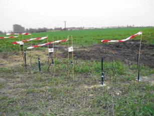
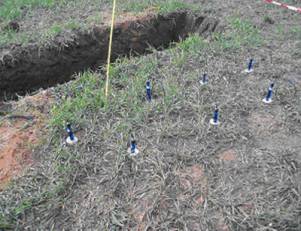
Basic questions
On two locations in different landscapes
intensive measurements of the soil and plant water balance are made and
compared with simulated results. In this context a continuous monitoring of
soil water data is implemented. Moreover an experimental research design is
realised for the spatial estimation of rooting intensity. This concept provides
that the soil water balance on two locations inside of one field is measured
during the vegetation period. The algorithms which are developed at these
intensive locations can be adapted to different soil conditions and be
spatially modeled with the aid of GIS in addition with significant pre-information.
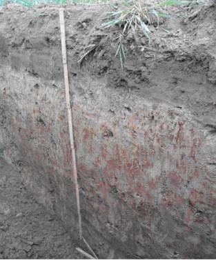
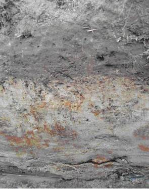
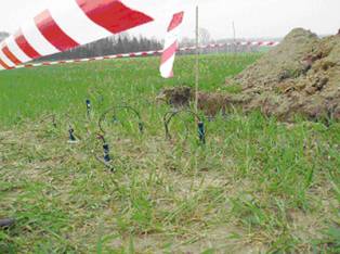
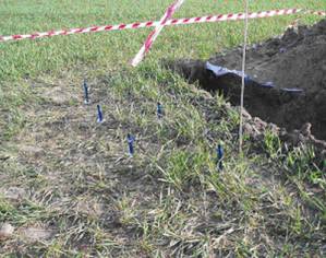
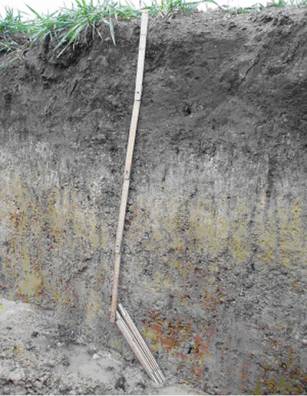
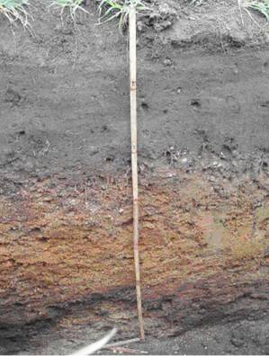
Pictures of the
intensive locations
Wulfen: Finkenherd (Schlag 141)
|
Profile 1 |
Profile 2 |
|
|
|
|
|
|
Groß Twülpstedt: Rabenberg
|
Profile 1 |
Profile 2 |
|
|
|
|
|
|